


MUSCATINE PCT 8, Muscatine County, Iowa
About
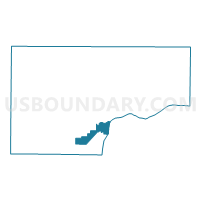
Outline

Summary
| Unique Area Identifier | 582922 |
| Name | MUSCATINE PCT 8 |
| County | Muscatine County |
| State | Iowa |
| Area (square miles) | 7.13 |
| Land Area (square miles) | 6.51 |
| Water Area (square miles) | 0.61 |
| % of Land Area | 91.39 |
| % of Water Area | 8.61 |
| Latitude of the Internal Point | 41.38688100 |
| Longtitude of the Internal Point | -91.09500840 |
Maps


Graphs
Select a template below for downloading or customizing gragh for MUSCATINE PCT 8, Muscatine County, Iowa


Neighbors
Neighoring Voting District (by Name) Neighboring Voting District on the Map
- DRURY Voting District, Rock Island County, IL
- FRUITLAND TWP PCT 1, Muscatine County, IA
- FRUITLAND TWP PCT 2, Muscatine County, IA
- MUSCATINE PCT 4, Muscatine County, IA
- MUSCATINE PCT 7, Muscatine County, IA
- SEVENTY-SIX TWP W/O MUSCATINE Voting District, Muscatine County, IA
Top 10 Neighboring County Subdivision (by Population) Neighboring County Subdivision on the Map
- Bloomington township, Muscatine County, IA (24,165)
- Fruitland township, Muscatine County, IA (2,534)
- Drury township, Rock Island County, IL (797)
- Seventy-Six township, Muscatine County, IA (312)
Top 10 Neighboring Place (by Population) Neighboring Place on the Map
Top 10 Neighboring Unified School District (by Population) Neighboring Unified School District on the Map
- Muscatine Community School District, IA (29,454)
- Rockridge Community Unit School District 300, IL (7,392)
- Louisa-Muscatine Community School District, IA (4,280)
Top 10 Neighboring State Legislative District Lower Chamber (by Population) Neighboring State Legislative District Lower Chamber on the Map
- State House District 72, IL (101,862)
- State House District 80, IA (29,774)
- State House District 87, IA (27,761)
Top 10 Neighboring State Legislative District Upper Chamber (by Population) Neighboring State Legislative District Upper Chamber on the Map
- State Senate District 36, IL (206,729)
- State Senate District 40, IA (60,420)
- State Senate District 44, IA (55,643)
Top 10 Neighboring 111th Congressional District (by Population) Neighboring 111th Congressional District on the Map
Top 10 Neighboring Census Tract (by Population) Neighboring Census Tract on the Map
- Census Tract 241.03, Rock Island County, IL (4,046)
- Census Tract 504, Muscatine County, IA (3,917)
- Census Tract 510, Muscatine County, IA (3,323)
- Census Tract 509, Muscatine County, IA (2,914)